
Chances are slim that you’ve ever heard of Tapia Canyon which is located in the back country near Cabezon Peak. This is another gem that we learned about through “Hiking in NM” on facebook. This trail has so many things to discover such as petroglyphs, natural arches, Native American ruins and a slot canyon. It’s not an easy trail to find on a map but we were able to navigate it through our AllTrails app. Once you get off of north Hwy 550 onto west Hwy 279 most of the travel is dirt road through parts of the Zia Reservation and eventually leading to the BLM and Chamisa Wilderness Study Area. It takes about an hour to navigate the 30 plus miles on the dirt road but it’s pretty amazing once you get there. It’s remote and a long hike, approximately 8.1 miles round trip along an arroyo that weaves back and forth through the canyon. We were advised to hike September through April simply because of the heat. It’s open space with little shade so you’ll need to carry sufficient water and snacks. We knew there would be little to no other hikers so we made sure to tell family members where we were going and what time we would check in, just in case of any emergency. The hike was challenging, especially walking in a sandy arroyo for much of the time. But it was one of our most treasured experiences, finding the petroglyphs that were so artfully displayed, the arches that appeared out of nowhere and the slot canyon at the end of the trail that was sculpted so beautifully by the wind. We didn’t go off trail to find the Native American ruins but there’s always next time!
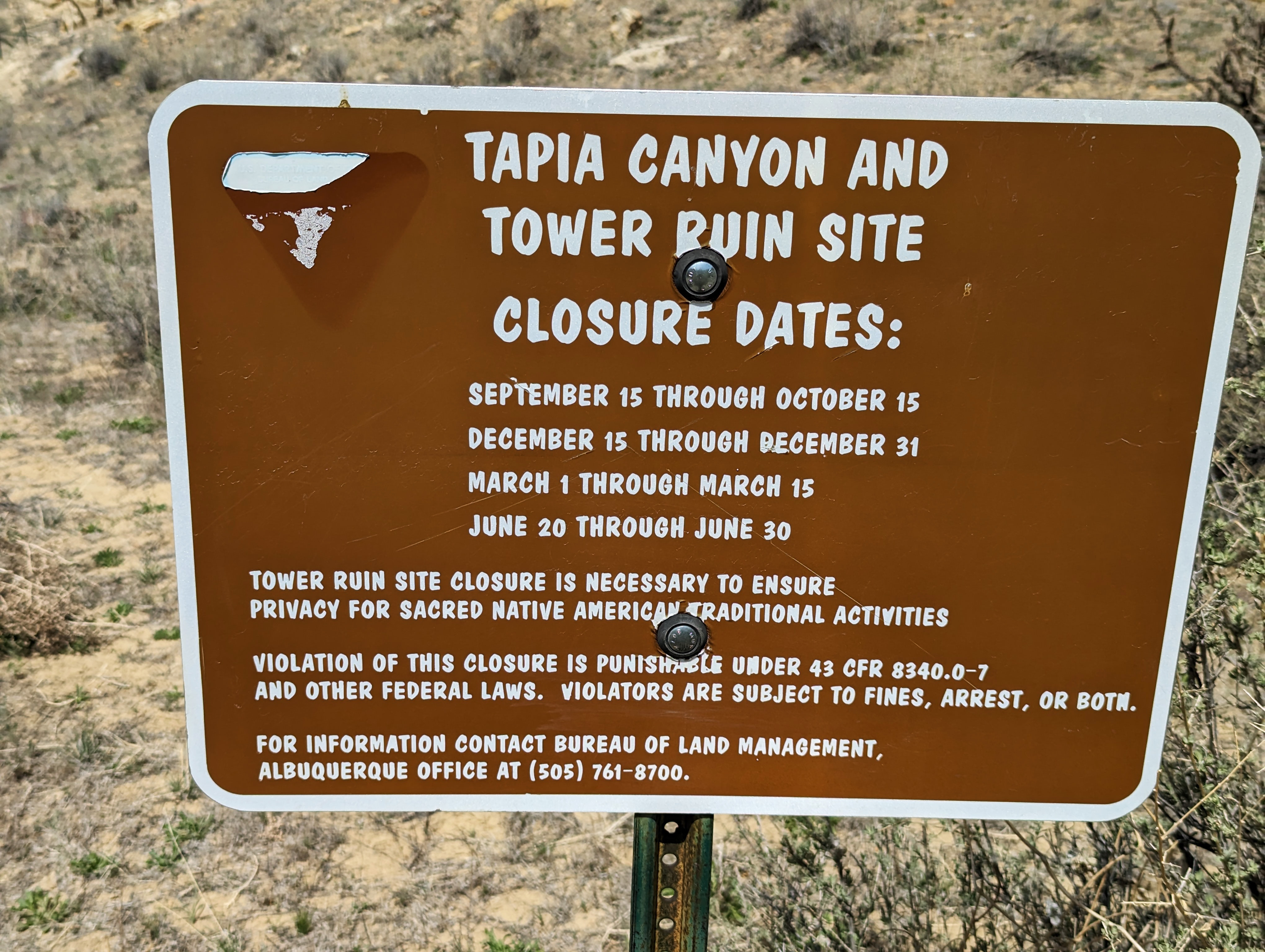
First thing, know when to hike Tapia Canyon. There is a sign at the beginning of the trail that has all the dates when there are closures for ceremonial activities. This trail is sacred to the Native Americans and thus we need to show respect so that we are welcome to witness the history that was left behind.
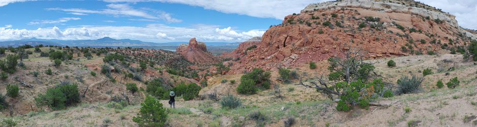
As you begin on the trail there is a long mesa on both sides of the trail. This is the view to our right.
This is the mesa to the left where you can see the arroyo below where water once flowed.

We are making our way down to the arroyo now.

Joe and I decided these rock formations looked like an eagle and a dog, what do you think? The one in the middle is up for debate.

A closer look at the rock formations along the way.


According to the map we knew the petroglyphs were nearby, however we didn’t realize they would be way up high on a bluff. It was hard to get a photo of the entire elk herd and story. The petroglyph art is hard to find and hard to see especially when the sun is shining on them. You have to crane your neck upward and then zoom in to get a photo. They must have had ladders to be able to reach this high to make the rock carvings. This is one of the most exquisite petroglyphs we’ve ever seen, there is so much detail in every carving. I wish I could decipher the story they meant to leave behind. The next photos are close up sections of this petroglyph.


Further up the trail we came across this rock wall with a few more petroglyphs. We know there is one more wall of petroglyphs, however we were unable to locate it this time. One day we hope to return and find it as well as the Tower Ruin site.

A little further we found the small arch.

It’s as if a hole opened up in the rock. Love that it frames the tree in the background.
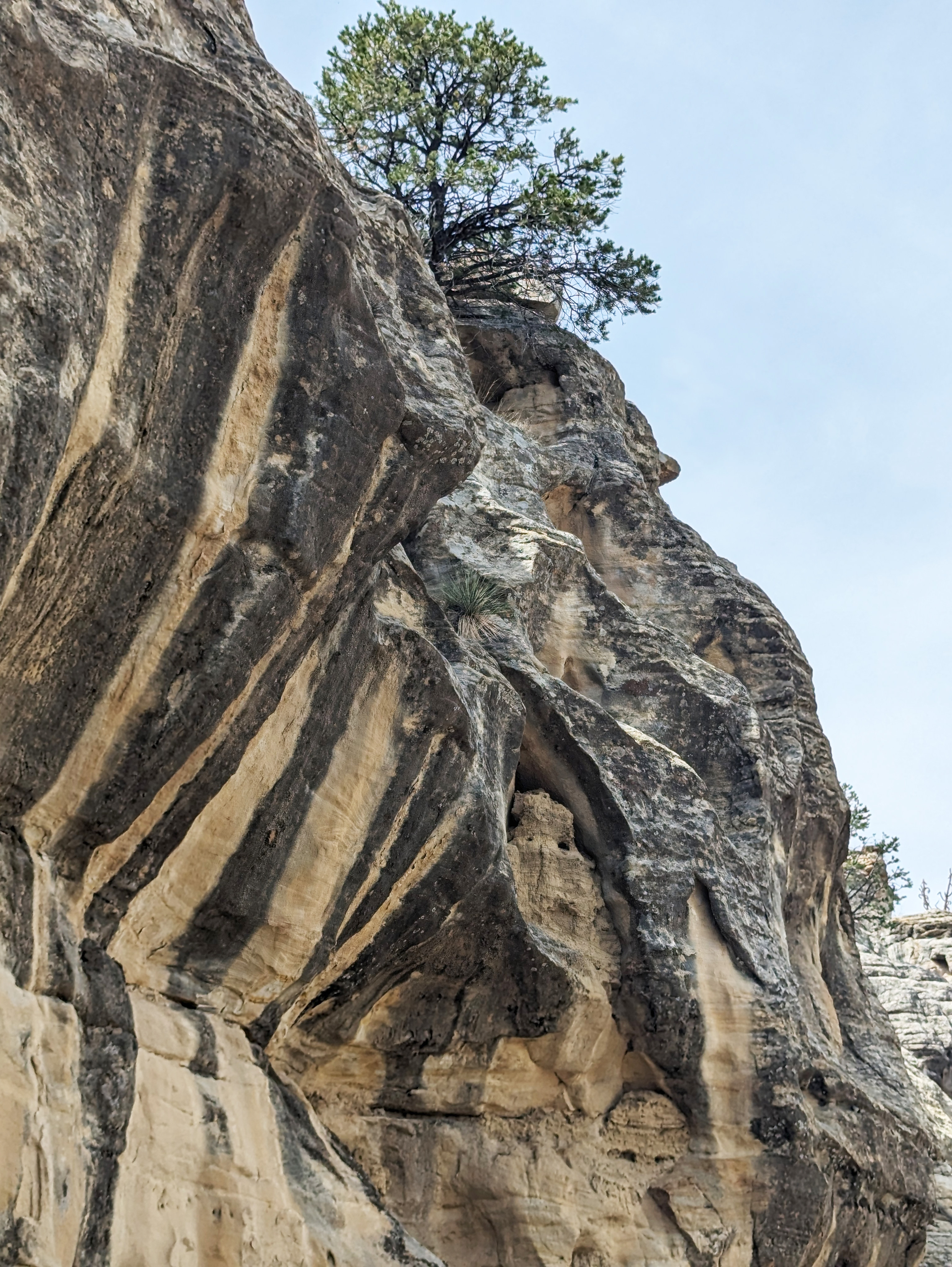
I love the stripes in this rock. Also, can you find the hoodoo imbedded into the rock about halfway up? It always amazes me how the trees take root and survive in the cracks of rock.

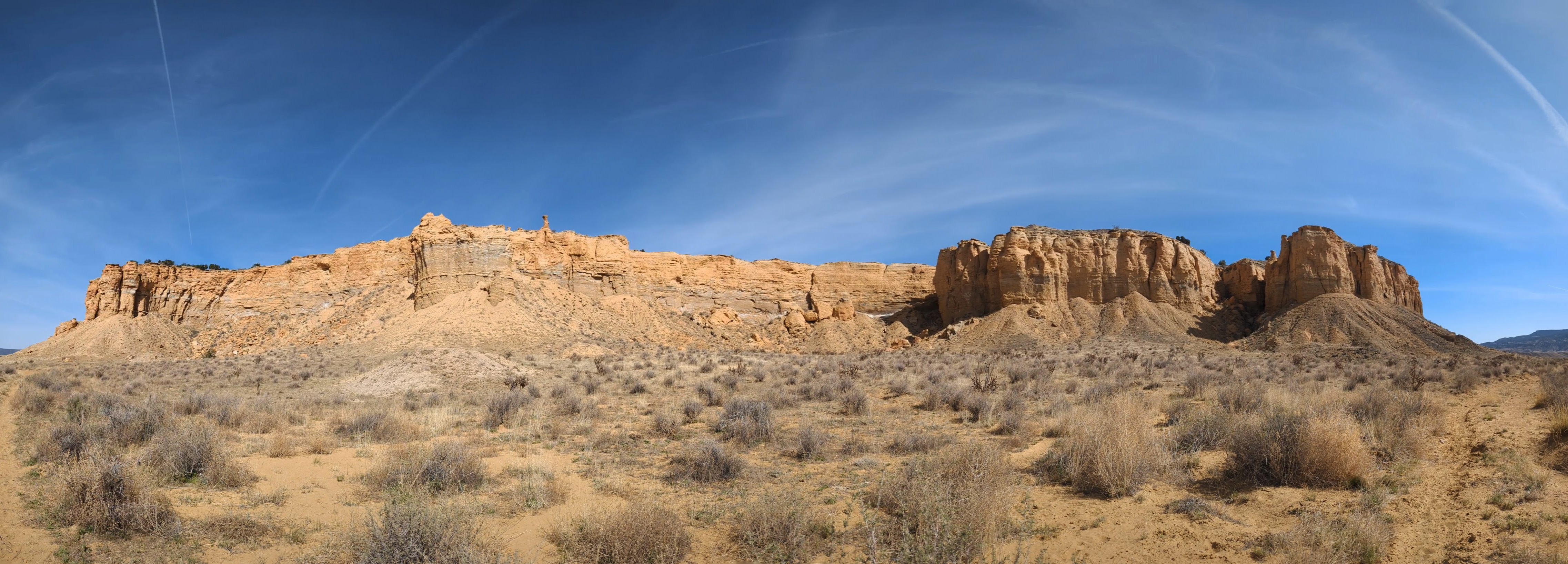
The sides of this mesa have been designed by wind and rain.

This pool is dry now but when it rains, the water will trickle down through the crack in the rock from above to fill with rain water.

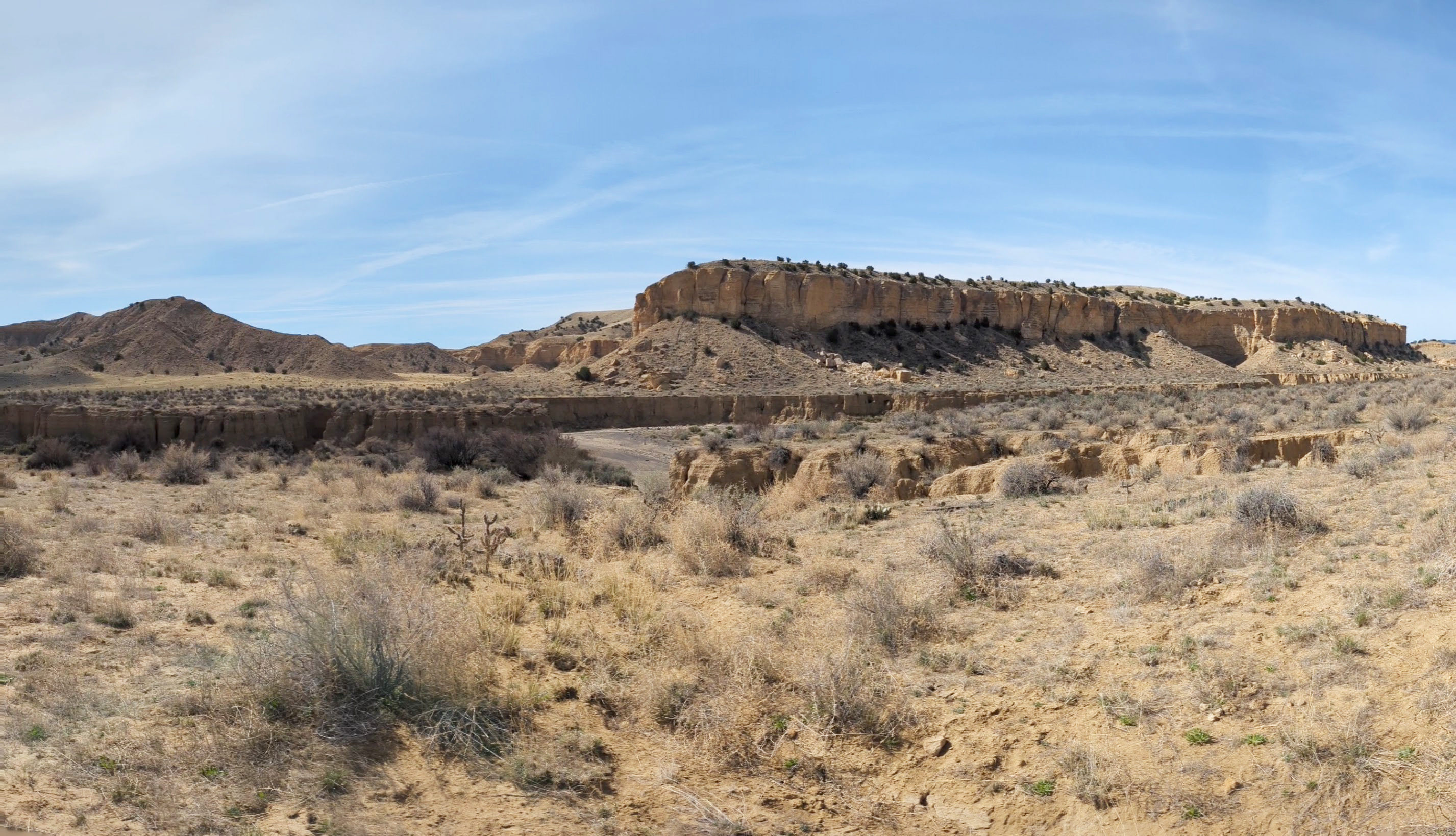
As we near the end of the trail we came through a volcanic area.
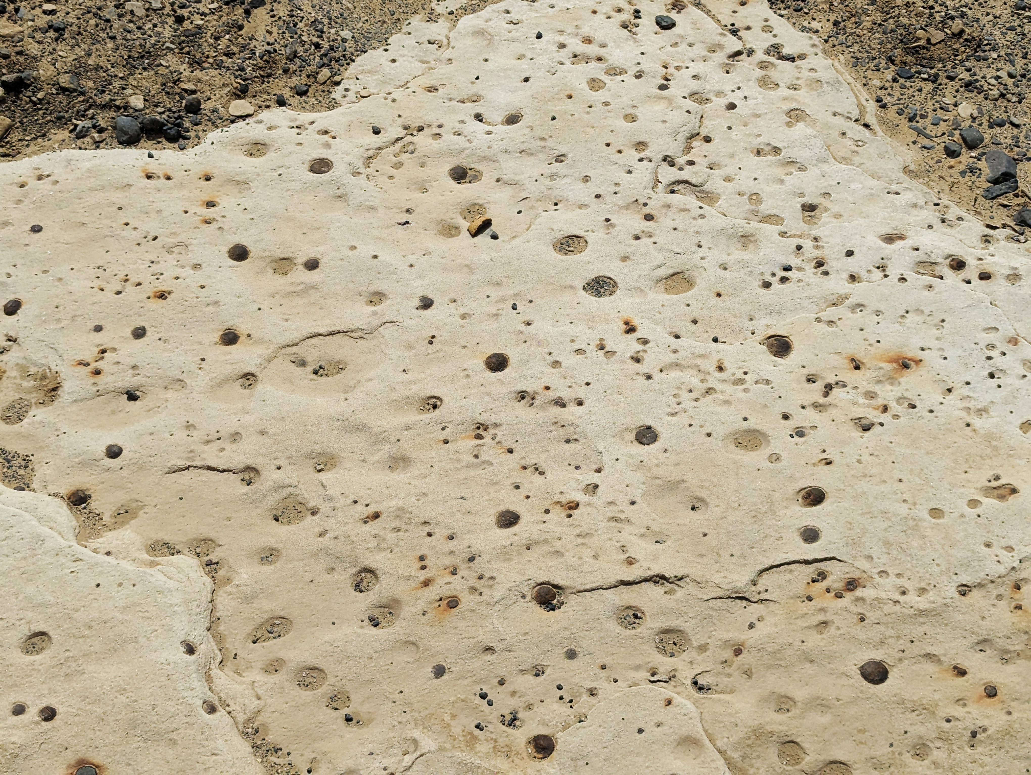
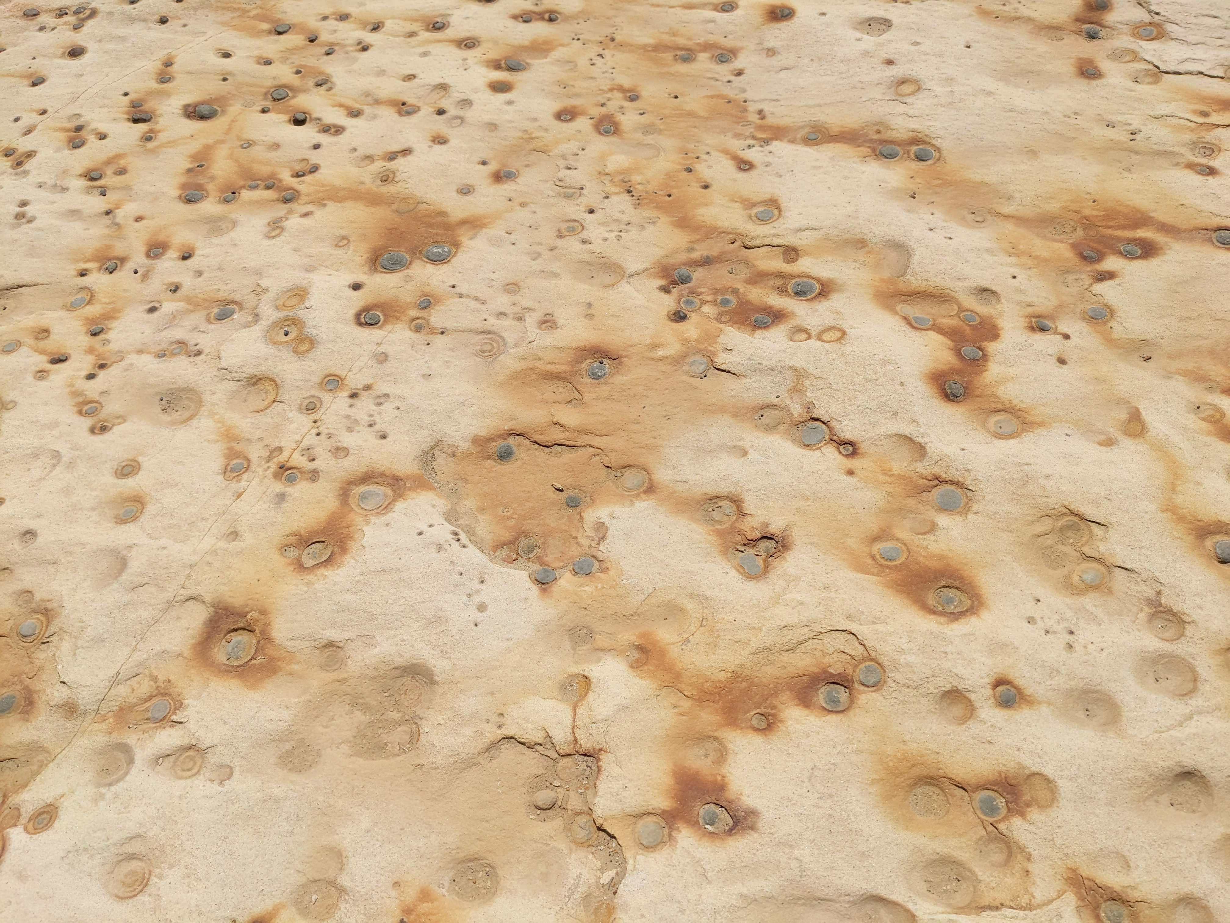
Here’s a closer look at the light colored rock, one part has fossil like circles dotted within the rock while the second photo appears like rust swirling throughout the dotted surface.

Some more cool layers formed by wind and sand.

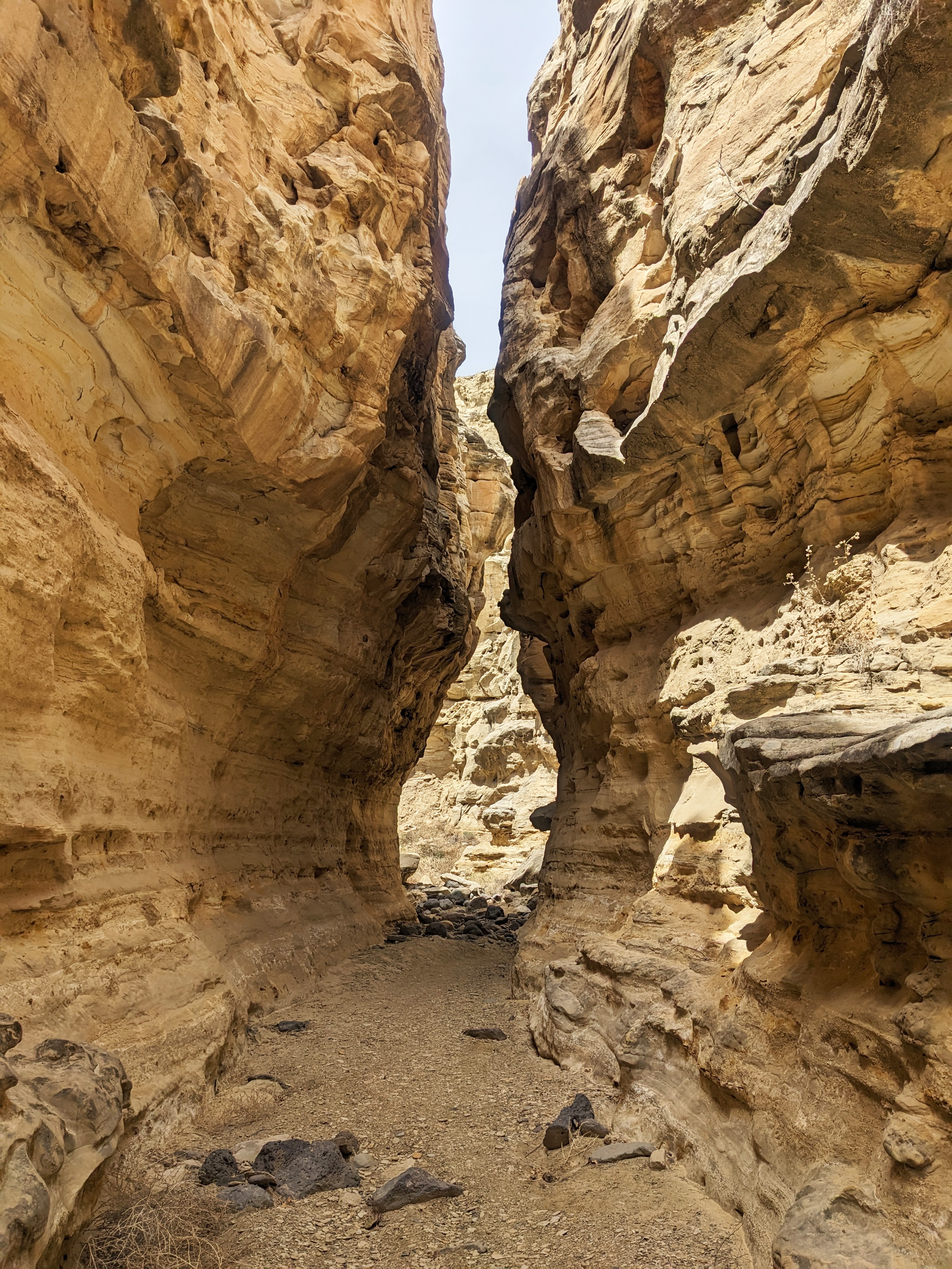
We have arrived at the big arch.


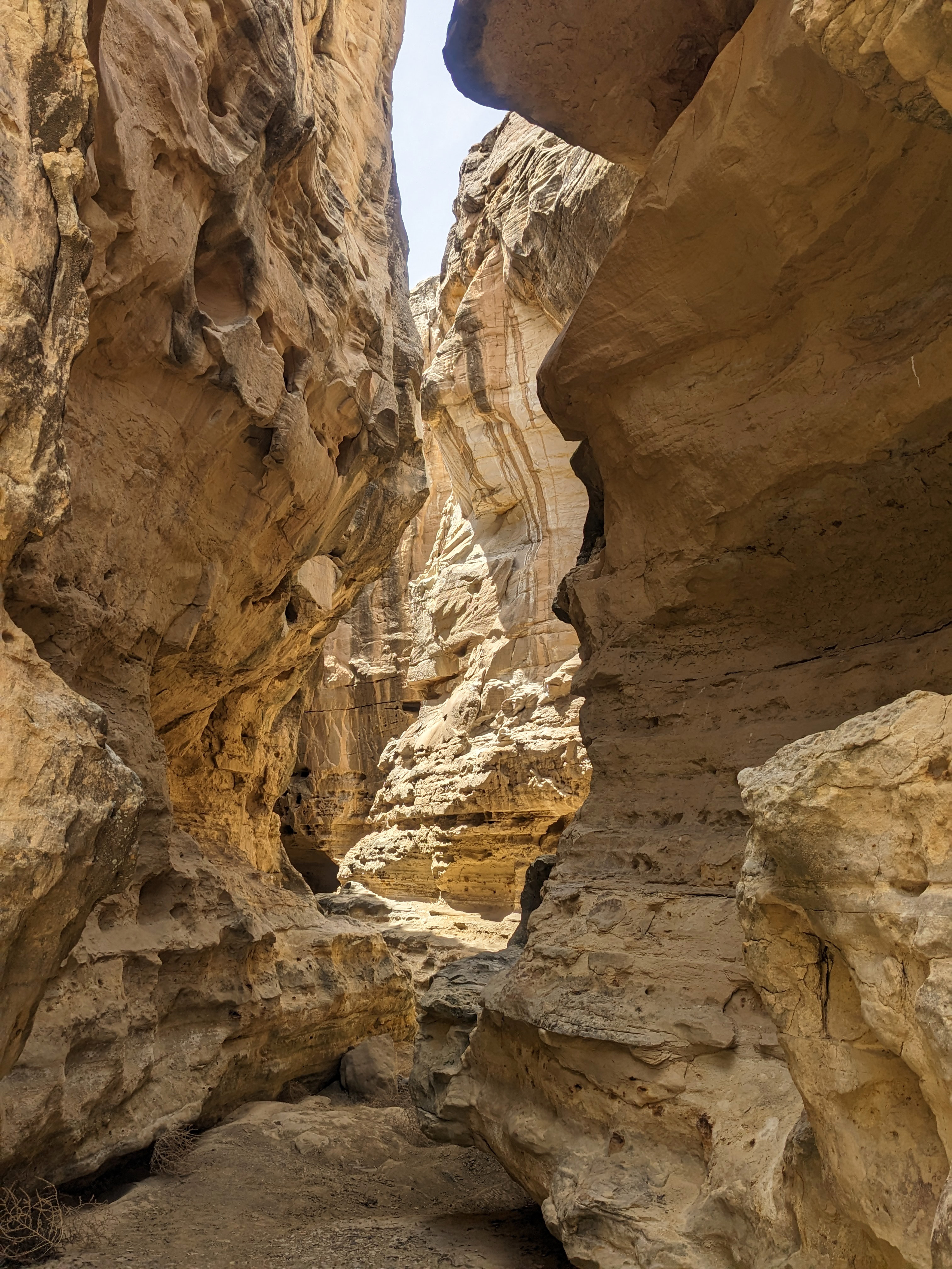
The alltrails map indicates we are at the end of the trail, however we know there is a slot canyon, so we ventured further.
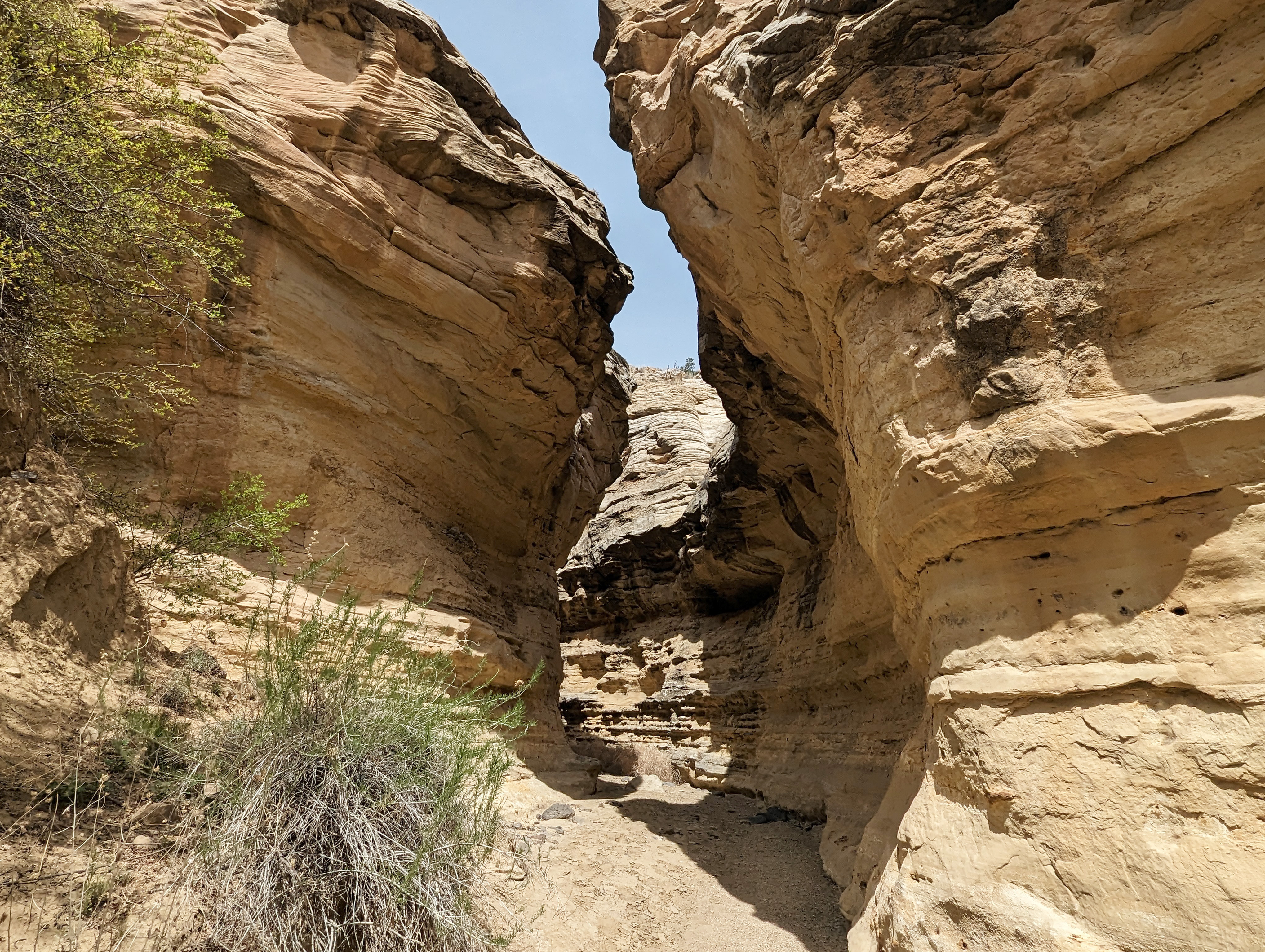
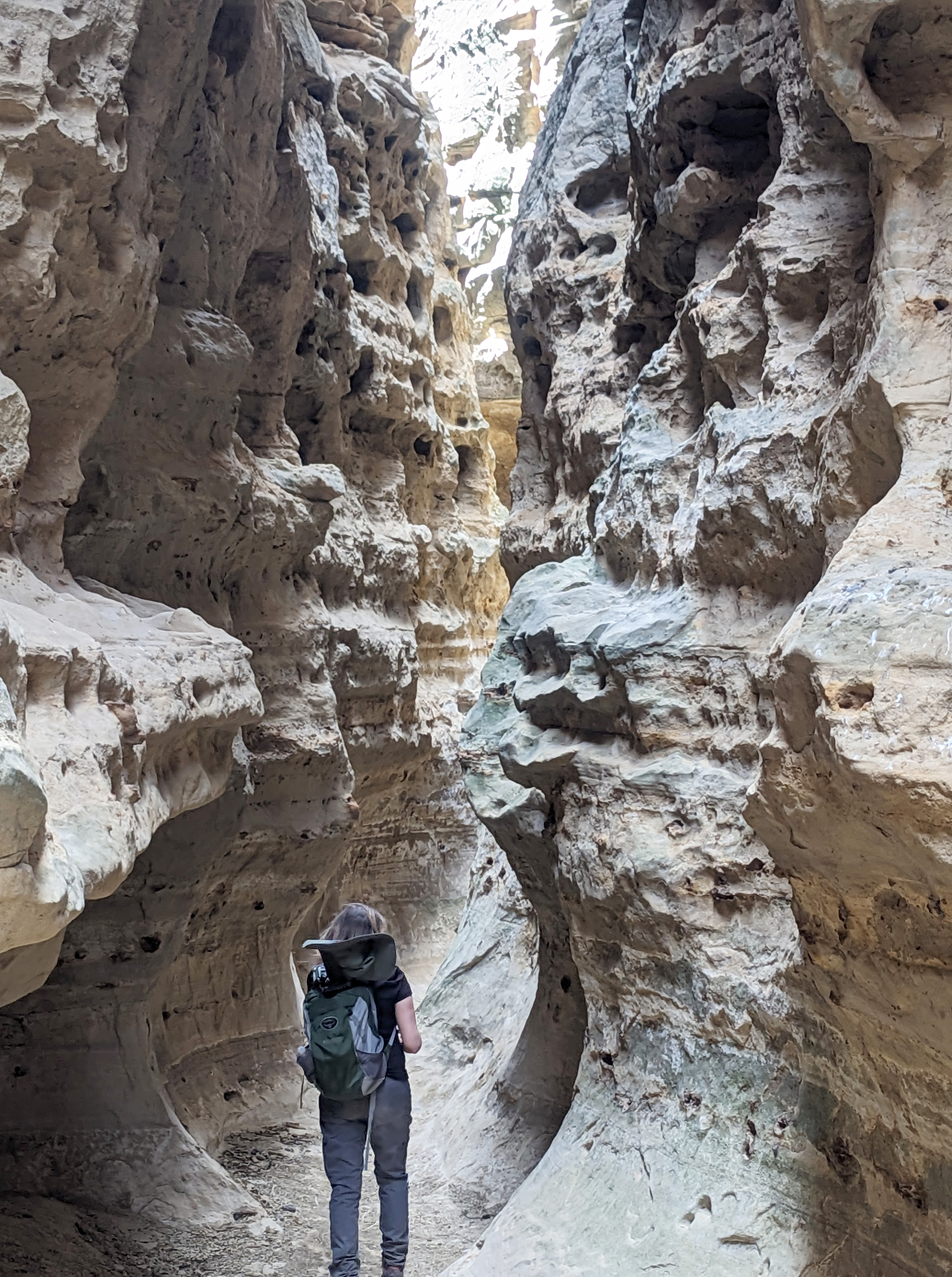
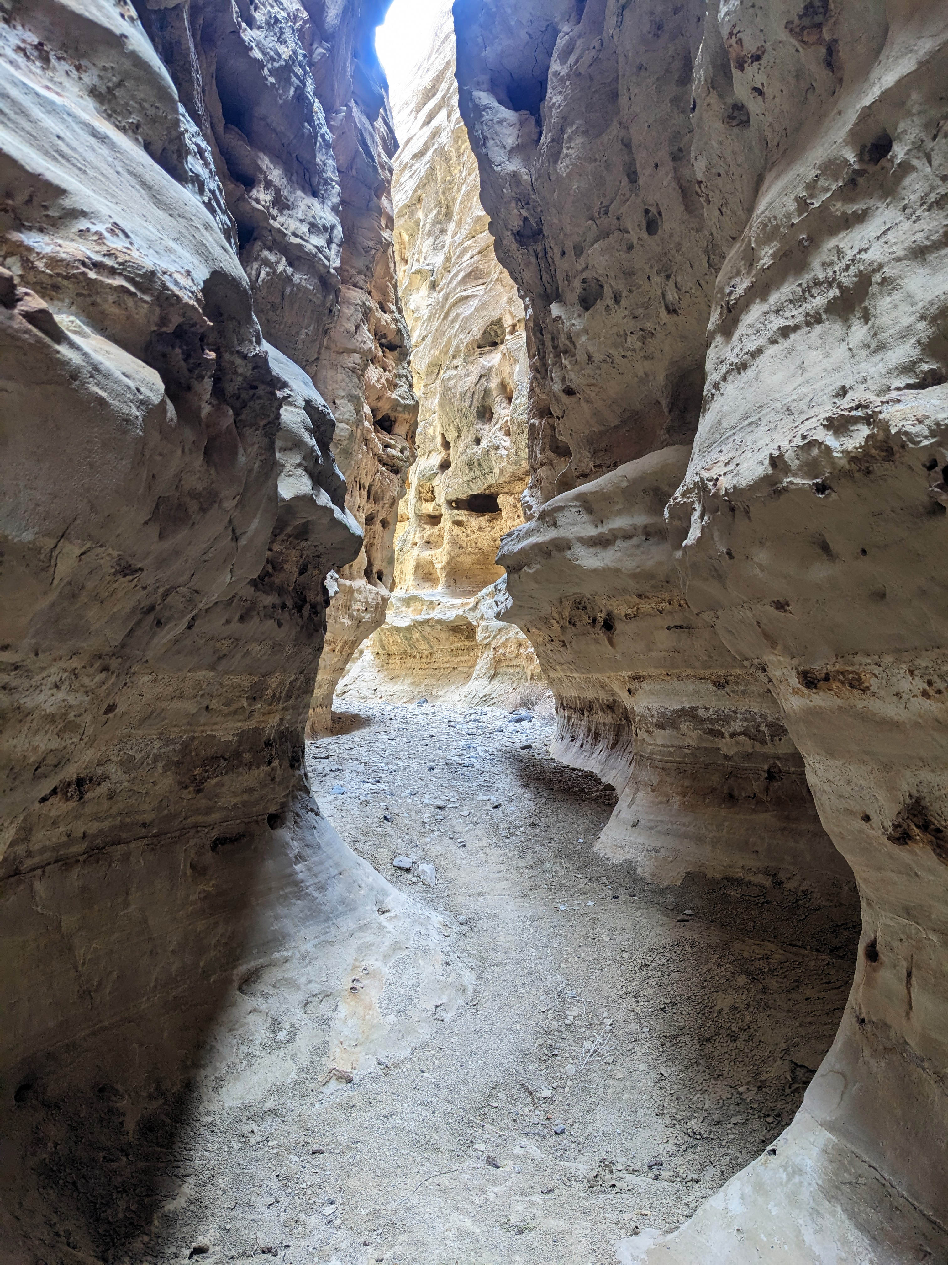
Just beyond the arch, we found the entrance to the slot canyon. We were surprised by how far back we could go. Take a walk with us as we explore the canyon.


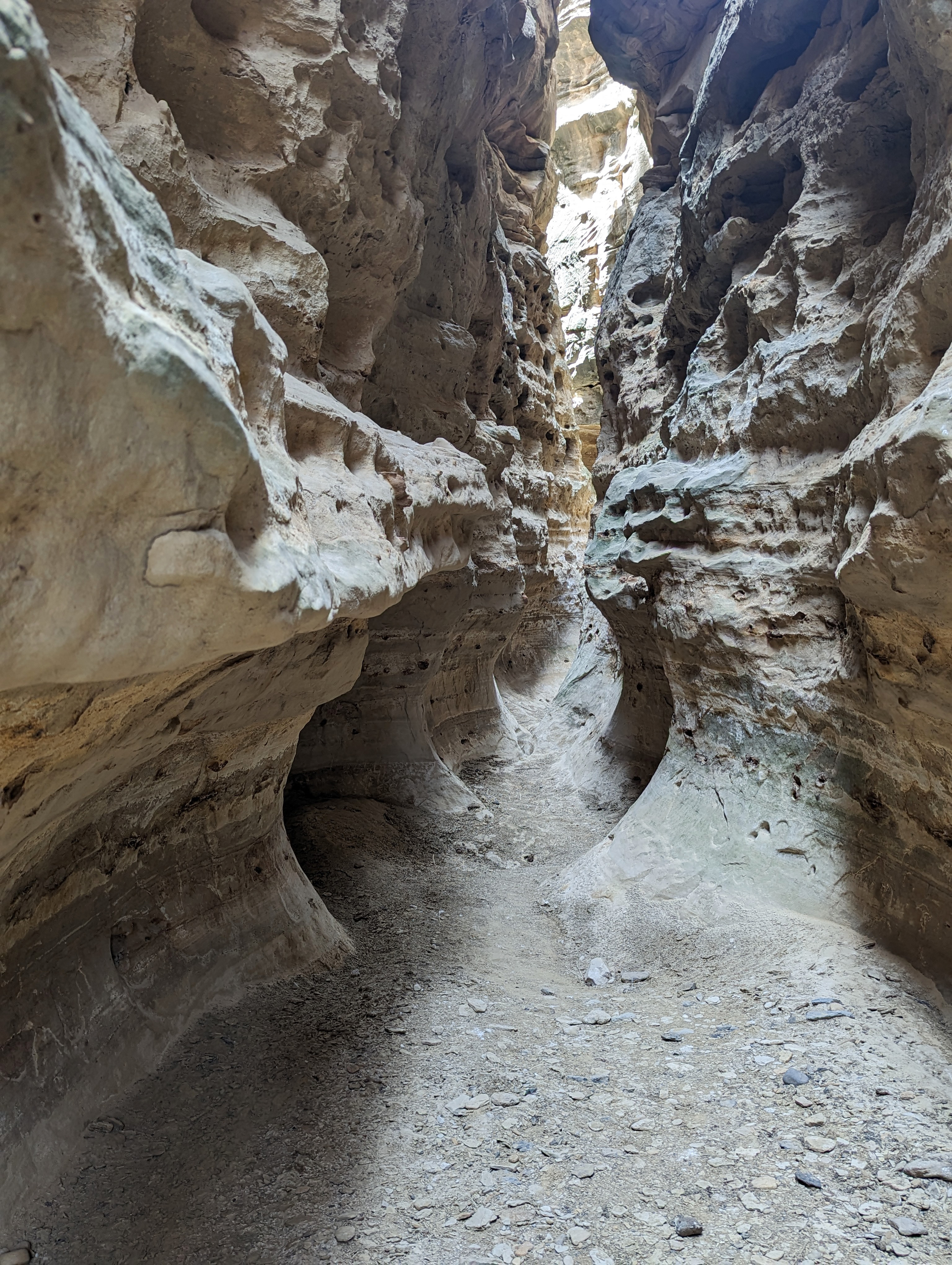
I’m in awe! This section of the canyon is my favorite part.

We decided it was time to turn around. We might have gone further, however this hole is deeper than it appears and quite slippery. At this point we felt it was better to be safe.

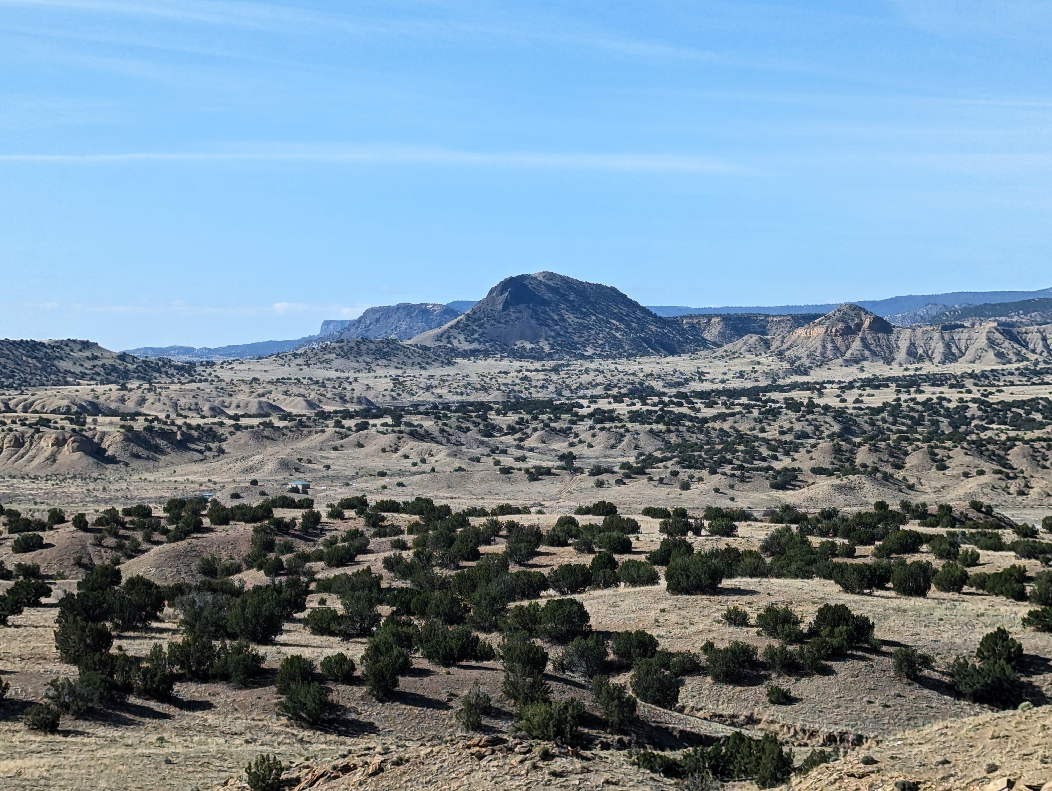
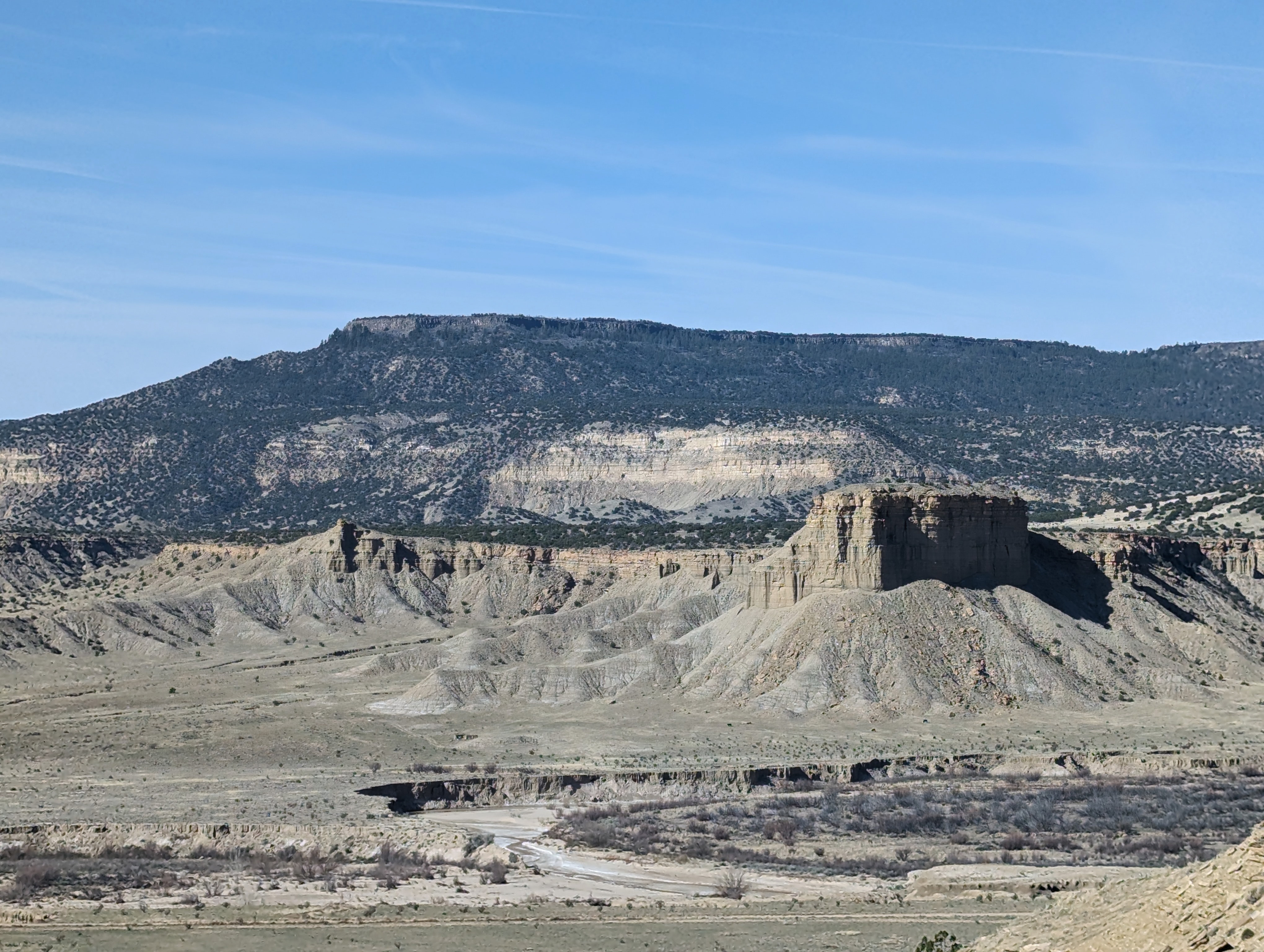
I hope you enjoyed tagging along with us on the Tapia Canyon Trail. These last photos were taken along the 30 plus miles through the back country of the Zia Pueblo and BLM lands. Cabezon Peak is on the left side. That’s a hike for another day!


6 thoughts on “Tapia Canyon”
Rosemarie's Kitchen
Beautiful! Thank you for taking us all along.
LikeLike
NativeNM
My pleasure! Glad you enjoyed seeing Tapia Canyon!
LikeLiked by 1 person
Dorothy's New Vintage Kitchen
It’s all breathtaking, what an amazing experience! Do we know the age of the petroglyphs? So detailed, and it looks like there is both a spiral and a labyrinth!
Thank you so much for sharing these beautiful images Jan!
PS The rock formation in the middle looks like a gorilla thinking to me.
LikeLike
NativeNM
Thanks, I wish I knew how old these petroglyphs are but there are no markers on this trail. Great guess, I can see a gorilla too!
LikeLiked by 1 person
Karen
Such an interesting hike and the details in the petroglyphs are amazing.
LikeLike
NativeNM
The petroglyphs were quite amazing! We know there is one more wall of petroglyphs, however we didn’t find it this time.
LikeLiked by 1 person