El Malpais National Monument is located approximately 80 miles west of Albuquerque off of Interstate 40. There are two exits off of I-40 that will take you to different sights and things to do along those roads. For the El Malpais Overlook and La Ventana Arch, take exit 89 South onto Hwy 117 for approximately 15 miles. The overlook point stretches for miles and miles across a landscape that is covered in old lava flows and sandstone bluffs. The view is amazing, showcasing a valley of lava fields with colorful Mesa’s surrounding the area. We hiked from the top down to the area below for a little over 2 miles. It was a beautiful walk that we enjoyed immensely. A few miles further south on Hwy 117 is the La Ventana Arch. La Ventana is one of the largest arches in New Mexico and is very easy to get to with a short half mile hike. It’s a stunning sight from afar but as you get closer you will be in awe of the enormous beauty of this arch. Across El Malpais on the west side you can take exit 81 off of I- 40 and travel south along Hwy 53 from Grants, NM where you can hike trails through lava tubes and old lava flows. There is a “Big Tubes” area in which you will need to stop by the El Malpais Visitor Center to obtain a wild cave permit in order to explore the caves. Currently all the caves are closed due to covid until further notice with the exception of the privately owned the Bandera Ice Cave and Crater. There is a small Trading Post on site where you can get tickets. A couple of years ago we took Cameron (our youngest son) to see the Ice Caves and Bandera Crater which is located along the continental divide. It’s known as the land of “fire and ice” with the Bandera Crater and Ice Cave where the cave temperature never rises above 31 degrees. It seems the more we explore New Mexico the more there is to discover.
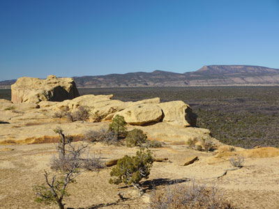
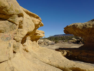
This group of pictures highlights the overlook area.

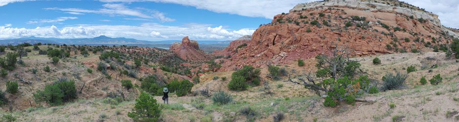
This group of sandstone bluffs are right on the edge of the cliff.
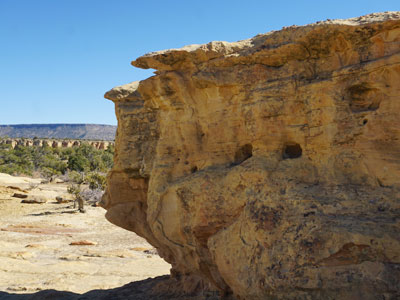

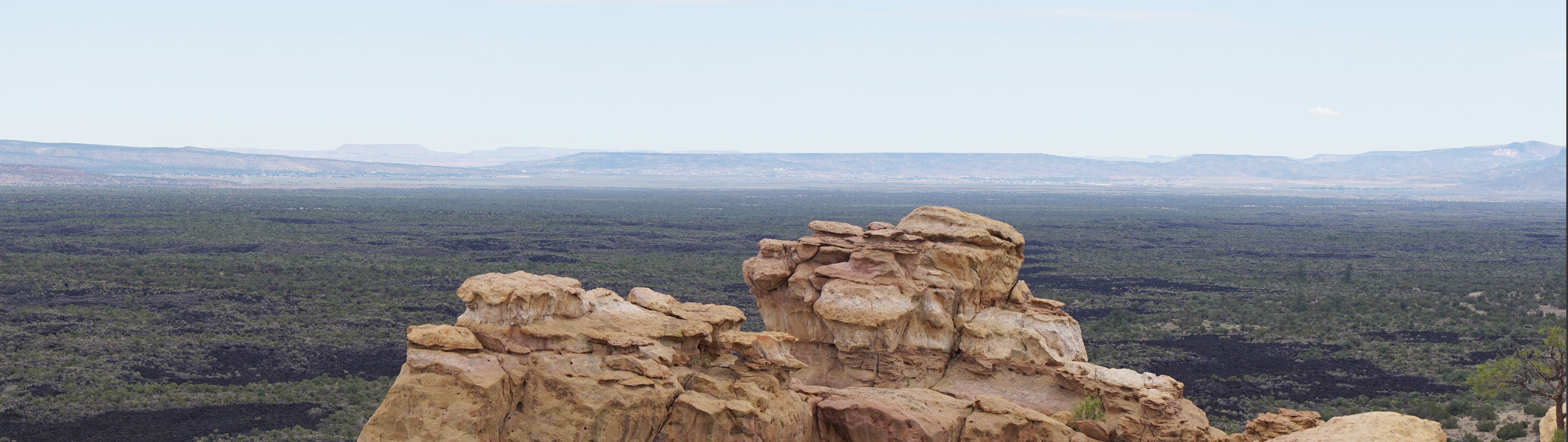
From this outlook point we head north on the trail which will take us about a mile or so to get down to the bottom.

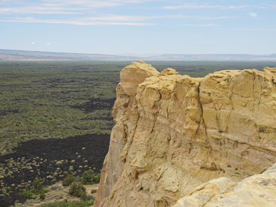
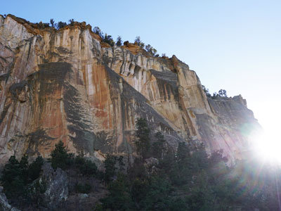
We walked along the rim as much as possible because the views are breathtaking!


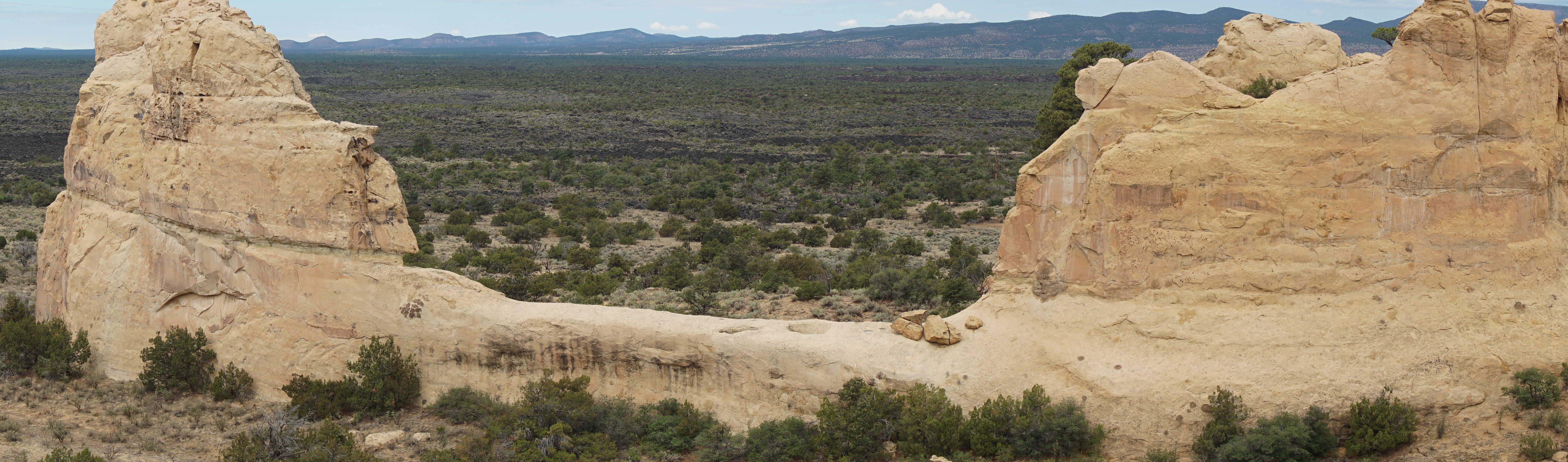
We are starting our descent downward and will go around these bluffs on a U-turn back along the bottom.
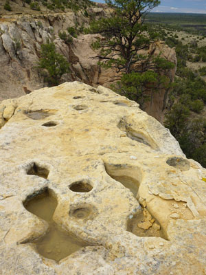
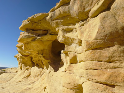
After a recent rain, the water pooled in the holes along the bluffs.

The rolling white clouds hovered over the Mesa’s in the distance.

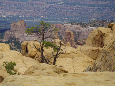
This is part way to the valley below.

Here are some panoramic views along the trail.


Puffy clouds were forming in the north as we headed back.

A little further south you’ll find La Ventana Arch! This is a beautiful place to stop and have a picnic lunch. The path is only a short walk to see the arch up close.


There’s my kid Cameron heading down to take a look at the ice cave. This was January 2019 and it was cool enough for a jacket but down in the cave it never gets above 31 degrees.
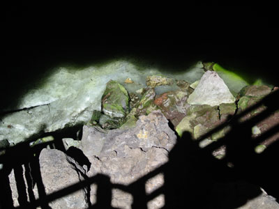
This is not the best picture to show the ice. The sun was too far overhead to shine a light on the ice. While we could see it in person it was not easy to get in a photograph.

A short hike from the ice caves sits the Bandera volcano crater.


4 thoughts on “El Malpais National Monument”
Karen
How very interesting. Thank you for sharing as I would never get those same views because of my fear of heights. 😊
LikeLike
NativeNM
The first time we went to the lookout point the wind was so gusty and at that point I did have fear of being blown off the cliff. This trip was much more subdued and I was able to relax and enjoy the sights.
LikeLiked by 1 person
Dorothy's New Vintage Kitchen
Amazing landscape!
LikeLike
NativeNM
Thanks to the internet I’ve found so many beautiful landscapes and hidden gems that I never knew about back when I was growing up in NM.
LikeLiked by 1 person