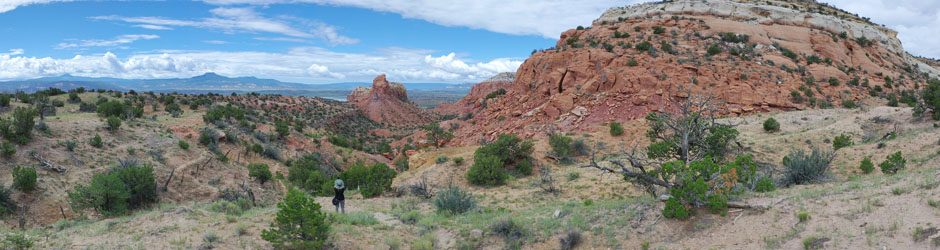

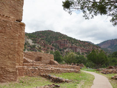
The Jemez National Recreation Area is located within the Jemez Mountains which is approximately 50 miles north and west of Albuquerque. Jemez is an easy 1 hour drive for Joe and I. We’ve explored many cultural landmarks as well as gorgeous landscapes that includes geological formations of granite and red rock as well as volcanic rock. The mountains are full of peaks and valleys, mesas of every color and box canyons to explore. Over the last couple of years we have taken many day trips to Jemez. Every path leads to something different such as old railroad tunnels, water falls, hot springs, a soda dam, historical ruins and a goblin colony. These are just a few of the many sights to see in Jemez. The mountainous areas are gorgeous with Cottonwood trees along the rivers and streams that attracts fly fishermen and Aspen trees in the higher elevation areas. The people who live within the Jemez Pueblo maintain many of the customs and traditions of their ancestors. It’s easy to see why the people of the Jemez Pueblo would make this area their home. In the summer Joe and I love to escape to Jemez where the mountainous areas are a good 10 to 15 degrees cooler than in the city. The Jemez area includes little side roads, many of them dirt roads, that will lead you down a path of awe and bewilderment. It’s hard to capture the beauty of this enchanted area but I hope you can imagine it and maybe one day have a chance to experience it in person.
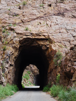
Gilman Tunnels

Gilman Tunnels are one of the few man made wonders in the Jemez Mountains. Named for Santa Fe Northwestern Railways executive William H. Gilman, the two tunnels were built in the early 1920’s through mountains of granite. The rail line began construction and laid tracks in 1924 to haul timber to a sawmill in Bernalillo. Heavy rain caused flooding which damaged bridges and washed away some of the tracks that caused such damage that the rail line simply abandoned it rather than spend the money to repair it. Now paved, the narrow road is used to travel through a rugged section of the Guadalupe Box Canyon. But many take the road just to see the historic tunnels. To get there take Hwy 485 west off of Hwy 4 from either direction. Travel on Hwy 485 for 5 1/2 miles where you can drive through the tunnels or there is designated parking before you enter the tunnels on either side of the road.

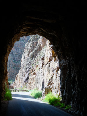
If you look closely you’ll see the second tunnel in the distance.
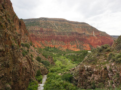
Some of the sights along the Gilman Tunnels Road.


The Rio Guadalupe runs through the box canyon.

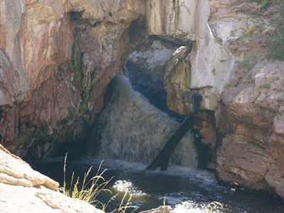
Jemez Soda Dam

The Jemez Soda Dam is a unique sight. It was formed by calcium carbonate and travertine deposits from thermal spring water that has built up over many years. The Jemez river flows through the dome which has created a bridge across it. The soda dam is located on Hwy 4 just north of the Village of Jemez Springs and Jemez Historic Site.

To the right you can see the steady steam that flows through the dam from the Jemez river.
A closer look.
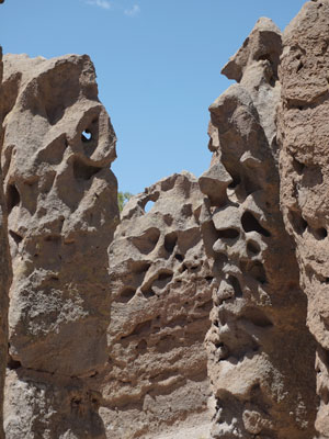
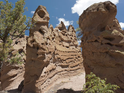
The Goblin Colony

I had never heard of the Goblin Colony until recently when I read an article from “Only in Your State”. From the posted photos I knew that it would be a magical hike. These goblins are hoodoos that have no caps on top. They appear smoother and about the same height. We discovered more hoodoos located on a steep slope above the Paliza Canyon. They appear different in size and shape than this group and are formed of volcanic rock. To get there from Hwy 4 turn east onto Hwy 290 which is paved for a short distance. When you get to the dirt road there will be a split, take Frontage Road 10 which veers to the right. Look for the Paliza Family Campground, continue past the campground a short distance until you see where the road splits. On the left you will see a small unmarked parking area. The trail which is around 5 1/2 miles out and back starts just across the road from the parking area.

When you walk down in and around the goblins you will find some amazing shapes.

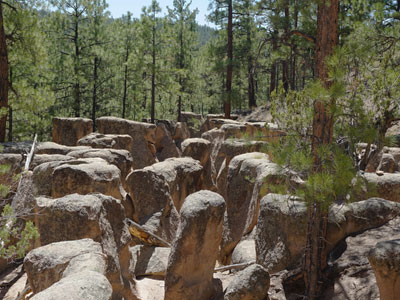
It’s like a small maze.

Further along the steep incline of the Paliza Canyon lies many hoodoos that are much taller and of all shapes and sizes. We were both out of breath from the climb but it was so worth it.


Jemez Historic Site

The history of the Jemez Historic Site goes back 700 years. According to the information provided at the historic site, the Jemez Indians established the Pueblo of Giusewa where the land was fertile and game was plentiful. They lived peacefully for many generations until a group of Franciscan missionaries arrived and tried to convert the Pueblo people to Christianity. The Franciscans demanded allegiance and used forced conversion at times to deny the people to practice their native rituals. The Franciscans designed a massive stonewalled church which was constructed with Pueblo labor. It was massive in size with a rare bell tower and was named San Jose de los Jemez. The site was occupied until the Revolt against the Spanish in 1680. The historic site is off of Hwy 4 just past the Village of Jemez Spring, and before you reach the Jemez Soda Dam.

The entrance at the back of the church.
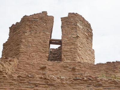
The bell tower.

Standing at the front of the church looking toward the entrance.
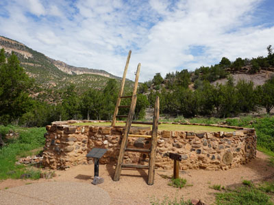
This kiva is well maintained with a large room and a tall ceiling. Photos were not permitted inside the kiva.
McCauley Hot Springs
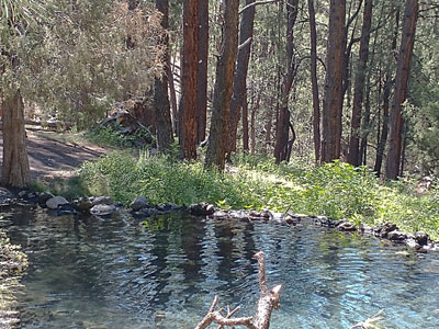
The trail to get to McCauley Hot Springs is somewhat deceiving. The first time we attempted the trail we somehow got off on the wrong path and ended up at a dead end. After some research we found that there is a switchback that we had missed. This time armed with our AllTrails app we navigated our way to the springs. We hadn’t planned on soaking in the springs but found that several others were already enjoying the warm crystal clear spring water. Our timing wasn’t perfect to get the pictures that really captured the beauty of the water, however the sun was at the right angle to capture the reflection of the sky and trees. We got there early enough to enjoy some peaceful time and take pictures but later when we wandered back down the trail there was a steady stream of folks who were on their way to enjoy the springs as well.

We parked at “Battleship Rock’ Camping area and took the East Fork Trail 137 for a 3.4 mile out and back hike to McCauley Hot Springs.
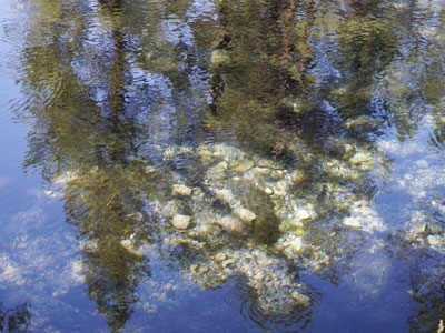
The blue sky and trees are reflected as well as ripples in the water.

I managed to get one picture that shows how crystal clear it was.

Another reflection.
Jemez Falls
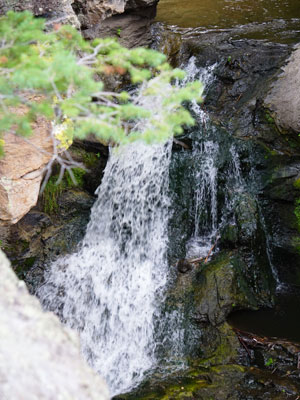
If you continue on the trail past McCauley Falls you can hike another 1 1/2 miles to Jemez Falls. We didn’t take this route, instead we continued north on Hwy 4 which looped around to a parking area for Jemez Falls. From there it is a short hike to the falls.
Wildflowers


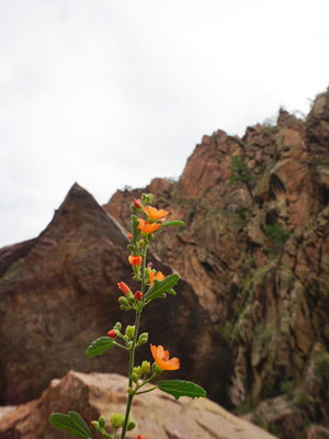

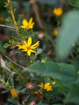
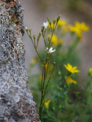
I always take pictures of wildflowers where ever we hike. Here’s a few that I took in the Jemez National Recreation Area.
The Drive to Jemez along Hwy 550 and Hwy 4

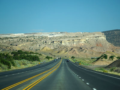

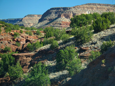
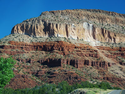
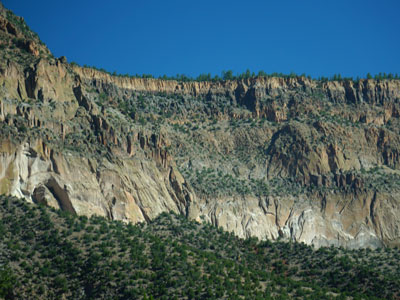
Just driving to Jemez is so beautiful. Some of the views on the road to Jemez.


4 thoughts on “Jemez National Recreation Area”
Karen
What a wonderful day of exploration and so many lovely sights to enjoy.
LikeLike
NativeNM
Yes, we are lucky to be so close to Jemez which has so much to see and do for anyone who enjoys being outdoors.
LikeLiked by 1 person
nmkat1952
We just planned a short vacation to Jemez in June. I used to go with my father there to fish oh so many years ago. Your blog has got me even more excited to go! Beautiful!
LikeLike
NativeNM
Thank you so much for your sweet comments. I hope you have a great time next June, Jemez is a wonderful place to be in the summer and so many off road treasures to explore.
LikeLike